
Snowmobiling in Northern Michigan and the Upper Peninsula
March 31, 2025 – 2:55 pm update: – MONDAY AFTERNOON – It’s the last day of the official 2024/2025 Michigan snowmobile season. There is still rideable snow in the Keweenaw Peninsula and in the Eastern U.P. The TASA groomers in the Newberry area are out for a final grooming run. Trails close on April 1, 2025 and grooming ends. You can still snowmobile on public lands where snowmobiling is allowed. After today, please be mindful of where you are riding to be sure you are not trespassing. Of course, do not snowmobile on trails where the gates are closed. Have a great spring, summer and fall and we’ll see you next winter.
Check the snow depth map for the areas the have the most snow.
Check back for updates…
Check the weather page for the latest weather updates
Check the snow depth map for the areas the have the most snow.
Here are the latest trail reports.
<>
<>
Here’s the Snow Depth Map to help you find regions with the most snow.
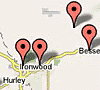
Keweenaw Peninsula — Ironwood / Western U.P.
Also check out John Dee for the latest weather forecasts.
Check the weather page for the latest weather updates and click here for the latest photos.
Check the Snow Depth Map for areas with the best snow.
Here are the latest trail reports.
Check out John Dee and the John Dee Forecast Graphic for his take on this week’s weather.
Complete trailreport.com reports on the web, facebook and twitter:
FACEBOOK – http://www.facebook.com/TrailReport
TWITTER – http://www.twitter.com/TrailReport
Forecasts from Weather Undergound: (Ironwood Forecast) — (Marquette Forecast) — (Newberry Forecast) — (Cadillac Forecast) — (Gaylord Forecast) — (Traverse City Forecast)
NEW: Webcam Map – View webcams throughout Northern Lower Michigan and the Upper Peninsula on our interactive google map.
You can follow the week’s weather forecast at John Dee.
You can track some of the lake effect snow on the Radar Loop here and also get an educated guess on the best regions for snowfall on the Winter Storm Warning Map.
You can view the snow depth map here.
To check temperatures and trail conditions throughout Northern Lower Michigan and the Upper Peninsula click on our new google interactive trail report map
Featured Regions For The Winter of 2013 / 2014
 Cadillac |
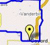 Gaylord |
 Traverse City |
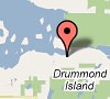 Drummond Island |
 Western U.P. |
Featured Regional Links
Western U.P. – Trail Reports – Webcams
Western U.P. Snowmobile Lodging
Ironwood – Hurley Lodging, – Montreal Haus Rental – Montreal, WI – Classic Motor Inn – Ironwood – Red Birch Haus – Iron Belt, WI – Comfort Inn – Ironwood – The Cedars Motel
Bessemer – Wakefield Lodging – Indianhead Mountain Resort – Regal Country Inn – Wildernest Chalet I & II – Wakefield – The Bluffs Inn – Bessemer – Big Powderhorn Lodging Association – Windsong Lodging – Bessemer – Powderhorn Northwoods Suite – Bessemer – SnowBlind Chalet 1-6 – Powder Hound Lodge
Lake Gogebic Lodging – AJ’s Walleye Lodge – The Timbers Resort – Root Cellar Resort – Bear’s Nine Pines Resort
Watersmeet Lodging – Jay’s Resort
Ontonagon – Porcupine Mountains Lodging – Mountain View Lodges – Scott’s Superior Inn – Superior Shores – Peterson’s Chalet Cottages – Rocky Shores Vacation Home – Porcupine Lodge – White Pine – Sunshine Motel – A Cabin & A Cottage Up North – Konteka Resort – AmericInn of Silver City – A Beach Retreat Cottage
Gaylord Area – Trail Reports – Webcams
Gaylord Snowmobile Lodging – Ray’s Retreat Country Inn – Pine Cone Accommodations – The Waters Inn – Treetops Resort – and more…
Gaylord Snowmobile Rentals – Alpine Snowmobile Rentals – DerMiner’s Parkside Market Snowmobile Rentals – Gaylord Dining
Harbor Springs Area – Trail Reports
Harbor Springs Snowmobile Lodging – Trout Creek Condominium Resort

Traverse City Area – Trail Reports
Traverse City Lodging – Ranch Rudolf – Honor Motel – Honor – Bayshore Resort – Pointes North Beachfront Resort Hotel – Cherry Tree Inn and Suites – Lake ‘N Pines Lodge – Crystal Mountain Resort & Spa – and more…
Traverse City Snowmobile Rentals – Blue Sky Snowmobile Rentals
Traverse City Dining – Peegeo’s – Ranch Rudolf
<>
Postings From Trail Report Pages On Facebook
August 20th 2025
Western UP Trail Reports
Trail 3 is getting a face lift today.
☠️ Stretch

Can't wait
This content isn't available right now
This content isn't available right now
When this happens, it's usually because the owner only shared it with a small group of people, changed who can see it or it's been deleted.HARBOR SPRINGS UPDATE via Harbor Springs Snowmobile Club >> 2025 Ice Storm Damage. The destruction to our trail system is overwhelming, and it will take an army to clean it up. Whether you ride these trails on a snowmobile, side by side, four-wheeler, drive them in your truck, hunt these woods, walk, or bike them, we will need your help. We have a meeting this Thursday at the Harbor Barn with the Mud Brothers & Beach’s Up North Tavern to get plans together for a trail clean up on 4/26. #harborsprings #petoskey
PARADISE - NEWBERRY AREA UPDATE via Chics Hot Dog Stand 8 and 452 Paradise >> Chic and Berda are at Pine Stump for lunch again. If you don't come up here riding, you are stupid! There, I said it....
Is there dirt in Siberia? YES
Are the drifts in Siberia?
YES
The rest of trail #8 makes up for it in
♠️♠️spades♠️♠️. Happy trails to you until we meet again ~Chic #paradise #newberry #snowphotosChic and Berda are at Pine Stump for lunch again. If you don't come up here riding, you are stupid! There, I said it....lol
Is there dirt in Siberia? YES
Are there drifts in Siberia?
YES
The rest of trail #8 makes up for it in
♠️♠️spades♠️♠️
Happy trails to you until we meet again
~Chic💜
I rode there on Tuesday and there is a bunch of snow. I took off from Pine stump
Heading up tomorrow!
KEWEENAW PENINSULA UPDATE via Visit Keweenaw >> 🥁 Drumroll, please! The Visit Keweenaw final snowfall count: 306.5"!
Our snowfall mystics have secured a two-way tie! ❄ Congrats to Dave and Randall, and may the fortunes be in your favor next winter!
📸 Photo: Chris Guibert #keweenaw #miweather🥁 Drumroll, please! The Visit Keweenaw final snowfall count: 306.5"!
Our snowfall mystics have secured a two-way tie! ❄ Congrats to Dave and Randall, and may the fortunes be in your favor next winter!
📸 Photo: Chris Guibert
WEATHER UPDATE via US National Weather Service Marquette Michigan >> Quiet weather is expected today as highs climb into the 40s with increasing clouds through the day. A cold front will bring light showers to the area tonight, with a wintry mix of precipitation types possible, but not much snow or ice accumulation is expected as lows fall near 30. #miweather #keweenaw #westernup #marquette #munising #seney #newberry #soo #straitsareaQuiet weather is expected today as highs climb into the 40s with increasing clouds through the day. A cold front will bring light showers to the area tonight, with a wintry mix of precipitation types possible, but not much snow or ice accumulation is expected as lows fall near 30.
KEWEENAW PENINSULA UPDATE via Visit Keweenaw >> ❄ Hei, Heikki Lunta! Over 300" of snow in the Keweenaw this season! How did your snow total guess fare? We'll give winter a few more days to say her final goodbyes - April 10th will call the official number and contest winner! #keweenaw #snowphotos #miweather❄ Hei, Heikki Lunta! Over 300" of snow in the Keweenaw this season! How did your snow total guess fare? We'll give winter a few more days to say her final goodbyes - April 10th will call the official number and contest winner!
For snowfall totals past and present, check here ⤵️
🔗https://www.visitkeweenaw.com/outdoors/winter-activities/snowfall-trail-conditions/
<>
<>